
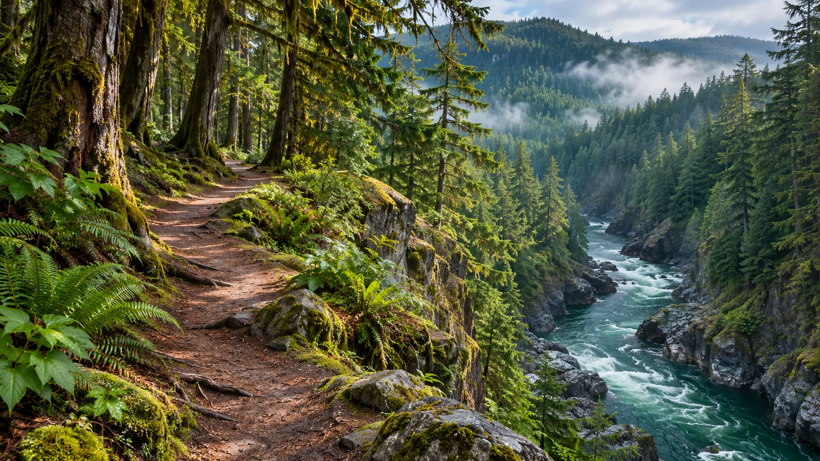
The Canyon View Trail at Elk Falls Park follows the lower Campbell River canyon. BC Parks describes a four-kilometre loop with access from near Quinsam Campground or the BC Hydro public parking area at John Hart. Read the park advisories before planning to complete the circuit. When a section closes, the useful question is which open stretch you can walk and return along from your chosen trailhead. BC Parks Canyon View Trail description · Elk Falls Park advisories
Choose the trailhead for the walk you want
BC Parks lists public access from across Highway 28 from Quinsam Campground and from the BC Hydro parking area at John Hart. Use the park map to locate the entry and plan a safe approach. If you’re camping at Quinsam, check how to reach the trail from your site and take care around the highway. If you’re coming from town in a car, confirm exactly which public parking area you need before starting. Follow the signs for the route from where you park. Elk Falls parking and trail map
John Hart has multiple destinations close enough to confuse a map search. BC Hydro provides separate directions for Canyon View Trail, the generating station and the Discovery Centre near the upper waterfall trail. If Canyon View is the main outing, use the directions specific to it. Once you arrive, check the map for the river crossing and trail junctions you expect to use. If you’re meeting someone, share the chosen parking area instead of arranging to meet at Elk Falls Park. BC Hydro John Hart directions
You can use either access point to plan a shorter walk if the relevant part of the trail is open. Compare where you’ll start with what you want to see. A person who wants a walk by the river may need a different starting point from someone intending to reach the bridge or join Millennium Trail. If someone in the group has an access requirement, check trail width, surface, crossings and grade with the park operator before committing to the walk.
Check which loop distance you are reading
BC Parks describes the Canyon View Loop as four kilometres. BC Hydro describes a six-kilometre circular walk that includes crossings on the logging road bridge and the Highway 28 bridge over the Quinsam River. Use the map and your planned access point to establish your route. The two descriptions are a reason to look at the exact lines on the map and any road sections before estimating how far you’ll walk.
Decide whether you want a full circuit or a section you can walk out and back. If a four-kilometre loop is near the limit for your group, include the distance from your vehicle to the trail and back. Look at how many junctions you’ll need to navigate. Allow a break to read interpretive information or see the river from a viewpoint. Time at those stops can matter more than the walking estimate on a busy afternoon.
The Millennium Trail connects the Canyon View area and the Elk Falls upper day-use network. BC Parks lists it at 2.5 kilometres and shows a connection near the Canyon View pedestrian bridge. If you add that trail, check the distance from the junction to your intended turnaround and include the return. If you want the suspension bridge and upper falls, you can plan those from the upper day-use area as a separate visit.
Read the closure before selecting a side of the river
A trail closure may affect a short stretch but still prevent you from completing the loop. Open the park advisory and read its description of the location. Compare that description with your chosen starting point and direction of travel. If there’s a closure map, use it with the main park map. Then decide what open section you can reach and where you’ll turn around. Follow signs and barriers at the site.
For a full circuit, confirm the river crossings and any connecting section required to return to the parking area. If the route around a closure would send you onto a road or an unfamiliar spur, pick an out-and-back walk on a clearly open section. Do the same if you reach a sign that differs from the saved map. Taking a shorter walk can still give you time by the river, with a simple return to the car.
Check water advisories even if the trail is open. BC Parks has issued a warning about dangerous high flows in the Campbell River and Elk Falls Canyon. BC Hydro explains that flows can change with operations at the active dam and powerhouse. Stay on the trail and heed signs and warning sirens. Look at the river from established viewpoints and leave the shore for another outing if the route you intended would put you in a hazardous area. BC Parks active flood advisories
Watch for changes at bridges and junctions
The lower canyon crossing is part of this riverside trail network. Read the map and signs rather than using the word “bridge” as your only direction. The upper Elk Falls suspension bridge has a different approach. On the Canyon View route, a connection to Millennium Trail is a point to check your bearings if you’re continuing around the lower loop. Confirm the name of the trail you need before following a branch uphill.
Some approaches and connections are close to roads. BC Hydro’s description calls out the logging road bridge and the Highway 28 bridge on its circular route. Watch for traffic and use only legal, clearly available pedestrian access. If those sections don’t suit your group, choose a shorter route that starts and ends at the same access point. Families can agree that everyone will stop at a junction before continuing so a child who wants to lead has a clear place to wait.
After rain, choose footwear for wet ground and keep time in reserve. Slowing down gives you room to read signs and negotiate a rough section without splitting the group. Carry water and an extra layer. If you’re walking late in the day, allow enough daylight to get back and check any posted access hours. BC Hydro publishes separate rules for trails on its property, including a requirement to keep pets leashed.
Spend time at the river viewpoints
The walk includes viewpoints and areas near salmon spawning and rearing habitat, according to BC Parks. Use the signed vantage points to notice how the river broadens or narrows along the canyon. The edge of the water can be hard to judge from above, particularly if the level changes. Keep to the trail and observe from wherever the park has provided access.
If you hope to see salmon, a short view of a particular channel can be a reason to pause. Ask locally about conditions and season and allow for the possibility that fish will be hard to see. Polarized glasses can help cut surface glare in some light. The river and canyon still give you subjects to observe or photograph. Notice whether the best view is upstream or downstream before choosing where to stop.
For a walk with someone interested in the river’s history, consider visiting the John Hart Discovery Centre separately. It has displays about the Campbell River hydroelectric projects, according to BC Hydro. Check seasonal opening hours and directions for the centre itself. The trail offers a chance to see the river from the ground, while the exhibits can help explain some of the structures and signs you encountered.
Fit the lower canyon into a day in Campbell River
If you have a half day for the area, give the trail enough time for the route you’ve verified and any stops along the water. If you have a shorter window, pick an open stretch and a point to turn around. The lower canyon can work well when you want a longer river walk. If someone is particularly keen to see the waterfall from above, give that upper day-use visit its own time and start from the upper access.
On a separate part of the trip, a four-hour marine wildlife tour from Campbell River takes you out onto the coast. Check the meeting point and time with Eagle Eye Adventures before pairing the tour with a walk. If you plan to do both on the same day, allow time to return to the car, drive into town and eat. Choose the length of the walk after setting those times. If a closure changes the route, use the shorter walk or come back on a different day. Eagle Eye Adventures marine wildlife tour · Eagle Eye Adventures departure information
What should I check before leaving the parking lot?
Find the current map and check your first junction and the route back. Decide whether the group is doing a loop or an out-and-back. Put any closure information where you can refer to it and agree on a turnaround time. If the first part of the trail takes longer than expected, shorten the walk before anyone is tired or daylight becomes a concern.
What if the Canyon View loop is partly closed?
Read which section is closed and choose an alternative using the open access and trails identified by the park. If you came specifically for a loop, consider returning after the reopening rather than making an improvised connection. If the waterfall is your main interest, check the status of the upper day-use approach separately.
Use the map to make three practical decisions
First, decide whether the road crossings suit the people who will actually do the walk. A confident adult on their own may choose a different route from an adult managing children or walking with someone who needs extra time to cross. Compare the access near the campground with the John Hart public parking approach and look at the road sections each would involve. If you’re uncomfortable with a crossing, check whether you can start from the other access and still get to the portion of the river you want to see.
Second, pick something along the route to serve as a turnaround if you need it. A signed viewpoint or named trail junction can give you a definite place to reassess. If you planned the loop and discover a barrier or find the footing difficult, use an already open section to retrace your route. A group that turns around earlier can use the extra time to read a sign, take a break or watch the water from a viewpoint. It also gives the slowest walker enough time to get back at their own pace.
Third, decide what you’ll do if a section of the walk is busier than expected. Near the river viewpoints, let people pass and choose places with enough room to stand back from the path. If you’re bringing binoculars, put them away when moving past people or navigating rough ground. Stop briefly to see whether the light reveals anything new in the water. You can return to the viewpoint another day if you want to spend longer there. A quieter visit can be a different kind of outing from a weekend loop when runners, walkers and anglers are sharing the same trail.
If you’re saving the route on a phone, keep a screenshot of the parking map alongside the current advisory, so the static map and current access information are both easy to find.
Share the map with the group so everyone can identify the same trailhead and return route.