
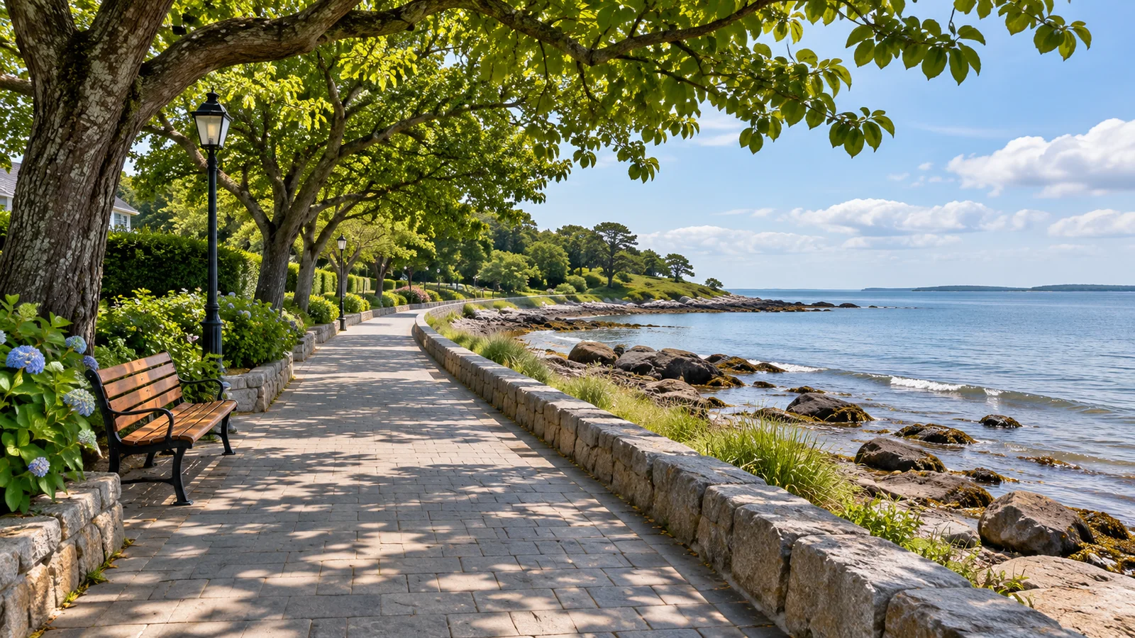
The Rotary Seawalk follows the Campbell River waterfront along South Island Highway. For a first walk, choose a park such as Rotary Beach Park, Frank James Park or Ken Forde Park and use it as the start and finish. Each gives you a different section of shoreline. The city’s parks and trails maps help you see where they sit and pick a route by how much time you have. City of Campbell River maps · Destination Campbell River trail guide
Pick the start that fits your walk
Rotary Beach Park is a practical starting point for a short visit to the shore. The city lists beach access, benches and picnic tables, trails and washrooms. If you’re meeting others, decide whether you’ll meet at the park or on the path. Start with a brief walk to see what the wind and footing are like. You can continue along the waterfront or use the park for a picnic and stay close to the car. City of Campbell River Rotary Beach Park
Frank James Park is a Willow Point starting point at 2084 South Island Highway. The city lists beach access, picnic tables or benches, paths and washrooms. Use it if your group wants to stay around Willow Point and make the walk one part of a longer visit. If you want a meal or a stop at a local business as well, look up the opening hours and the walking route before deciding which direction to head. City of Campbell River Frank James Park
Ken Forde Park is farther south, at 2501 South Island Highway. The city lists walkways, beach access and a boat ramp, along with picnic tables or benches and washrooms. It works as a starting point for a southern waterfront walk or as a named turnaround from another park. Give vehicles and people using the ramp room. If you want to stop for a picture, pick a place clear of traffic and the path. City of Campbell River Ken Forde Park · City parks map
Set a route by landmarks and your available time
Distance figures vary with the stretch and how a return is counted. Destination Campbell River’s hiking page describes a 13-kilometre return along the paved path. If you’re going for an hour or less, the useful distance is between your chosen start and turnaround. Find both on the city map. Work out how much time you want to spend walking out, looking around and returning. A park is an easy turnaround to explain if some of the group wants to walk farther.
For a short walk, use Rotary Beach Park as a base and walk until you reach a planned time limit or a point that makes sense to turn. You can spend more of the visit looking out over the passage or have a picnic if you want to walk less. This also works when your group has mixed walking speeds. Let the person who needs a slower pace choose the outward distance. If there’s time on the return, you can stop to look more closely at the shore.
For a longer walk, connect two named parks and return along the same path. Look at the map for the distance between them, any crossings and suitable places to stop. If you’d prefer a one-way route, arrange the return ride or check transit for the actual day and time. Confirm that you can reach the stop on foot and cross safely from the path. A plan with a fixed pickup can give you a longer stretch of waterfront as long as everyone can reach the agreed endpoint. BC Transit Campbell River schedules and maps
Watch the waterfront change as you walk
Start by looking across Discovery Passage. As you move along the Seawalk, the view changes with the angle of the shore and the weather. Pick a place to stop well clear of other walkers and cyclists. Look for a difference between the protected water near the shore and what you can see farther out. When the wind picks up, you may want a sheltered break sooner than you expected. Carry a layer for the time you’ll spend standing still.
If you want to see a named landmark, look it up in advance. The City park map shows Big Rock along the waterfront, and Destination Campbell River identifies Rotary Beach Park and Willow Point among the places to visit along this stretch of coast. Think about whether you want a landmark as an endpoint or an excuse to spend more time in one part of the route. A first visit can give you time to see the shoreline without a long list of stops. Destination Campbell River beaches and parks
You can see the coast from the paved route at different tides. If you want to go down to the beach, choose a designated access and check the tide and surface first. The walk down can involve different footing from the paved trail. If the tide or waves make the shore uncomfortable, stay on the path and use one of the benches or wider places to look out. You can keep the same start and finish without leaving the path. Canadian Hydrographic Service tides, currents and water levels
Plan around surface, crossings and facilities
A paved route makes it easier to choose an outing with a stroller or mobility device, but check the specific parking, approach and crossings you’ll use. If a washroom is important, the city’s park listing tells you what facilities are present. Ask the city for current hours or access details. A beach access from a paved path can have a different slope or surface. If the shore is the main reason for the trip, check that part of the visit separately. City of Campbell River parks and trails
The Seawalk is used for walking, jogging and cycling. Keep room for people coming from either direction and move out of the line of travel when you stop. If you’re with a group, walk in a way that leaves space for someone to pass. Keep children close at crossings or around parking areas. If you’re walking a dog, follow posted rules and keep it close where people are sharing the path.
When a path or parking area changes, use the city’s notice and directions at the site. If you are extending the outing downtown, the Seagull Walkway between Robert Ostler Park and the Government Wharf is a separate connection within the wider waterfront network. The city has an upgrade project for that walkway and says affected parts would close during work. Check the status independently if you plan to add it. City of Campbell River Seagull Walkway project
Make room for a waterfront walk around a boat tour
If you’re booked on the Eagle Eye Adventures four-hour marine wildlife tour, check the Coast Marina meeting point and instructions before choosing a Seawalk start. Pick a short walk with a clear turnaround if it comes before check-in. Allow time to get back to the car or bus and reach the marina. A longer walk can make sense on a separate morning or after you’ve had time to eat and change following the tour. Eagle Eye Adventures marine wildlife tour · Eagle Eye Adventures contact and location
The two outings give you different ways to see the coast. On the path, you can pick a section and spend time looking from one point. On the boat, you can see the shoreline from the water and spend more time in the channels around the islands. If wind or rain changes one part of your day, choose a length and start that make sense for the walk. A picnic, a half-hour out-and-back or a walk between two parks can each fit a different window.
Two short visits you can build from the same map
If you’re staying downtown and want to visit the Seawalk before lunch, choose your starting park and use the route to it to decide whether you’ll walk, drive or take transit. Save the return trip before you leave. On the waterfront, walk until you reach the point where there’s time to get back and still arrive for lunch comfortably. If the wind is up or someone has cold hands, return sooner and use the rest of the time somewhere sheltered.
If you’re staying around Willow Point, use the map to decide between Frank James Park and Ken Forde Park. Compare which one is closer to your room and which gives you the waterfront stretch you want. If someone in the group wants to go farther, set a time and place to meet rather than assuming everyone will walk the same distance. At the end of the day, you can leave the car where it is and use a route back from the park if the connections are suitable.
Where should I start with only a short window?
Use a named park, check how you’ll reach it and choose a brief out-and-back. Rotary Beach Park is one option. If you’re already near Willow Point, Frank James Park may be closer. Use whichever gives you more time walking and less time getting to the path.
Can I go to the beach from the Rotary Seawalk?
The city lists beach access at Rotary Beach Park, Frank James Park and Ken Forde Park. Check the specific approach, surf and tide before going down. For an easier return, stay near the designated access you used and note where it meets the path.
Choose a section for the weather and the light
With a clear morning, choose the section that gives you the view you came for. Use a named park or landmark as the starting point, then allow a few minutes beside the water before you move on. If you’re interested in photographs, make the first frame from a spot with a clear view and try the same view on the return. The changing light can pick out the line of the shore or make the far side of the passage easier to see. Bring something to protect your phone or camera if rain is possible and step away from the path to use it.
In heavier weather, use the same map to find a shorter route. A park with a washroom and a nearby turnaround makes it easier to choose when to stop. If there is one part of the walk you most want to see, start as close to it as you can. The return can feel different with wind in your face, so leave enough time for it. Check the city’s map and notices, and change the outing if conditions close or affect your chosen approach. City of Campbell River news and notices
Plan a meeting when part of the group wants a longer walk
A named park and a set time make a practical arrangement for a mixed group. For example, some people can stay near the benches at Frank James Park while others walk partway towards Ken Forde Park and return. Agree whether people waiting at the park will stay there or go elsewhere for food. If you decide to meet at Ken Forde instead, confirm who will move the car and where everyone can wait clear of the boat ramp.
If you’re planning a picnic, keep it close to the start or end so people can carry what they need without taking it the length of the path. Bring water and make a plan for where to go if rain arrives before the others get back. A shorter walk with a shared stop can work for a group that wants different distances without dividing the rest of the day.
For a meetup after dark, choose a place you can identify easily from the road or path. Check lighting and the final approach before expecting someone to find an unfamiliar parking area on foot.