
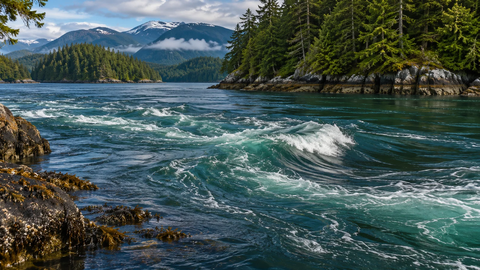
Tidal currents carry water through Discovery Passage, the channel beside Campbell River. As water passes through constrictions such as Seymour Narrows and flows around points, it can form fast streams, eddies and boundaries between areas of different flow. Those features can affect where plankton and small fish collect or become accessible, which in turn can influence where larger animals feed. What happens varies with the location and phase of the current. A patch of moving water offers a clue to the habitat and little certainty about which animal will be there. Canadian Hydrographic Service sailing directions for Discovery Passage Field study of predator and prey patterns in a tidal ecosystem
Look across the passage from a public shore viewpoint. One strip can look smooth, and another can carry lines of ripples or foam. A fixed point on the far shore helps you see whether the pattern is travelling or taking shape in roughly the same place as new water moves through it. The place where the two textures meet can be easier to notice than the current itself. A bird feeding near that boundary gives you one more observation about how the water and wildlife overlap.
A tide height and a current describe different things
The tide is the changing height of the water. A tidal current is the movement of water. Canadian Hydrographic Service publishes predictions for water levels and, at designated stations, current speed and direction. Its Seymour Narrows current station lists the timing and character of flow for that location. A water-level prediction for a shoreline station answers a different question. If you are comparing wildlife observations, note which kind of prediction you used and which place it describes. Canadian Hydrographic Service tides, currents and water levels Seymour Narrows current predictions
The shape of the channel influences how tidal water moves. When water is driven through a constriction, the flow can be concentrated. Around a point or beside a stream of fast-moving water, nearby patches can move differently. The Canadian sailing directions describe strong tidal streams in parts of Discovery Passage and identify Seymour Narrows as its narrowest portion. That gives local physical context for the wildlife question. What an observer sees from shore depends on the specific patch of water and its connection with the rest of the channel.
A wide view can show several surface patterns at once. Smooth water alongside rippled water may mark a boundary, but wind, waves and local shelter also change the texture. If foam or loose vegetation moves along that line, you have additional information about what is happening on the surface. Even then, the motion at the surface provides only an indirect view of what fish may be doing below.
How flow can make food easier to reach
Marine food is distributed unevenly. Plankton can be carried with the water, and small fish can move towards favourable conditions or aggregate in schools. Where currents meet or pass over changes in the bottom, they can mix water or help bring organisms into a different layer. In some tidal systems, researchers have found concentrations of prey and predators associated with these physical features. The mechanism gives you something to look for in Discovery Passage, while the location and timing of any particular feeding event need local evidence.
An area can become useful to a predator in more than one way. There may be more prey in a small area, or prey already in the area may move to a depth that the predator can reach. For a bird taking prey near the surface, a school deep in the channel may offer little immediate opportunity. If that school comes into reach, birds may gather quickly. A diving predator has a different range of choices. Animals that feed in the same channel therefore need not respond to the same patch at the same moment.
The place where a current slows or changes direction can matter too. Think of a fish moving along the edge of a strong stream. It may take advantage of food arriving in the flow while spending time in a nearby patch where it can hold position. A predator can benefit from the predictable route of prey passing a point. Whether either process is happening in a particular place is a question for observation. The presence of a rip or eddy gives you a possible explanation to compare with what the animals do.
What research elsewhere can tell us
A study of harbour seals in a narrow tidal channel found that their intensive use of the area varied with the currents. The researchers considered whether water movement changed the availability of prey or how efficiently seals could catch it. The research describes the seals and current regime in that study area. It gives a tested example of a link between tidal flow and predator behaviour that a visitor can consider when watching another channel. Research on harbour seal use of a tidal channel
Another field study examined how predators and prey were distributed in a tidal ecosystem by observing biological and physical conditions together. That approach matters because the conditions are changing as the animals move. If you only record a flock and a line of foam, you know the two features occurred near each other in your view. If you also measure prey and water movement, you can ask whether the position or timing of the flock fits a specific feeding mechanism.
Those findings are better guides to questions than to predictions about a Discovery Passage outing. You could ask whether feeding birds appeared near a current boundary, whether they stayed there as the flow changed and what other evidence indicated prey. A current prediction by itself leaves out the presence of prey, the animals’ movements and the visibility you had from shore. Watching under several conditions gives you a way to compare the observations without expecting one phase to produce the same result every day.
Read the behaviour as well as the water
Feeding activity usually gives more information than the number of animals alone. A group of birds sitting at the surface could be resting. Birds repeatedly diving and returning to a narrow area show a different pattern. A seal that makes repeated dives near a point could be searching or feeding, but you may be unable to tell unless you see prey or another direct sign. Give each observation a description that another watcher could recognise.
Look at the bird’s position relative to the current boundary. Does it come up near where it went under, or is it carried farther along before it surfaces? Is the whole flock moving in one direction? From a fixed shore viewpoint, the position of the birds may change while a line of ripples stays near the same point. That view helps you distinguish a feature fixed by the shape of the channel from the movement of individual animals or surface material.
A rip, eddy or foam line can also be conspicuous with very little wildlife visible. The animals may be elsewhere, the prey may be deeper, or activity may be hidden by waves. If the sun is shining into your field of view, a small bird or marine mammal can pass through without being noticed. In clearer light, the same observer might see more. Treat the conditions as part of the record, particularly if you plan to compare visits.
What changes between two visits
Suppose you watch the same stretch of Discovery Passage twice. During the first visit, several birds dive along a narrow boundary beside visibly moving water. During the second, the surface is calmer and the birds are scattered. You can compare where the birds were and whether they were diving. To make a closer comparison, record the time, station if you used a current prediction, the direction you were facing and how much water you watched. An account of fifteen minutes from one point is easier to interpret than two sightings without times or locations.
The comparison also benefits from a note on what stayed similar. If you used the same public viewpoint and looked at the same span of water, the observations have a common frame. If the water was rougher the second time, note which parts of that span were harder to see. If one visit took place while the light was falling, small animals may have been less conspicuous. These details help you assess whether the difference in observations came from a difference in wildlife, a change in visibility or both.
For a longer visit, break the record into intervals. You may find that the most striking feeding activity lasted only a minute, while the same surface boundary persisted throughout. That is information worth preserving. It tells you that the animals and the water overlapped briefly in your view. The interval before and after gives context for what was happening when the two things were no longer visible together.
Why the shore can tell a different story from mid-channel
The water next to shore can interact with small headlands, bays and shallows even as a much larger stream moves down the middle. Watch a piece of floating vegetation already in the water. It may linger near the edge of a bay while foam farther out continues along the passage. The two paths provide clues about surface movement on different scales. The nearshore movement can matter to small fish using shallows, while birds or mammals in deeper water can use another part of the flow.
When you record what you saw, include which of these areas you could see clearly. “Birds dived near the bay mouth while the centre of the passage looked rough” preserves two locations. If you write “birds preferred rough water,” you’ve joined a behaviour in one spot to conditions somewhere else. A landmark can help keep the two observations in the right place.
What to watch from shore or on a guided outing
A public shore viewpoint gives you a steady reference for the position of points, bays and surface features. Stay where you can watch without entering the water or moving onto slippery rocks. You can compare the same line of shore at different times and notice whether a visible boundary changes position. Eagle Eye Adventures’ guide to the Discovery Islands and nearby activities gives context for exploring the area around Campbell River.
On the Campbell River marine wildlife safari, a guide can help you interpret the relationship between current and wildlife when you can see both. The visible surface is just one layer of the channel. Travel conditions and wildlife encounters vary, and the crew manages the vessel. If you have a current chart open as a passenger, use it to understand the setting and ask about a feature you noticed. The biological observations here can help you describe what you saw from a safe viewpoint.
Is the strongest current always the best time to see animals?
The strongest flow at a station tells you something specific about water movement at that location. Different predators may use different conditions, and they still need prey they can reach. A few birds feeding well away from the fastest water can be more revealing than a stretch of strong current with nothing visible. Watch where the animals are, what they are doing and how the nearby water looks. Those three observations help you form a more useful picture than a current prediction by itself.