
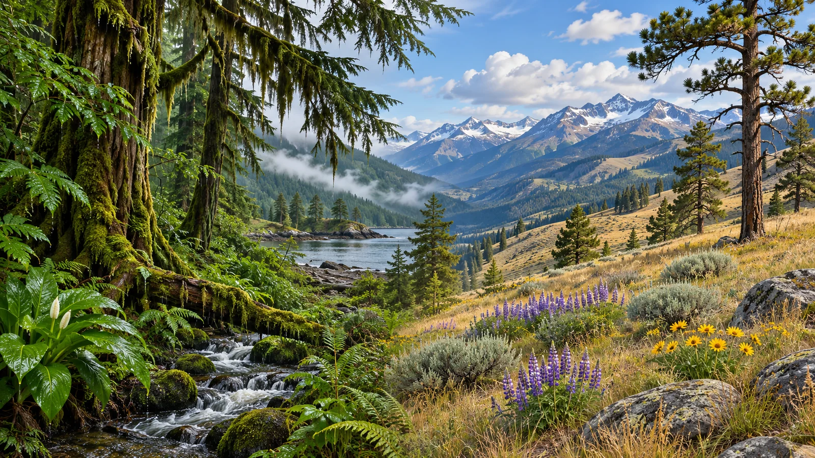
Coastal and interior grizzlies in British Columbia belong to the same species. Their habitat differs in the foods, cover and seasonal conditions available in particular places. A coastal watershed can combine tidal wetlands, wet forest and streams that bring returning salmon inland. An interior drainage may offer roots, berries, meadows, mountain slopes and animal foods, with fewer or different opportunities to catch sea-run fish. These are broad patterns, and both regions contain many kinds of habitat. To understand where a bear spends time, start with the local watershed and ask what it can reach through the year. BC grizzly assessment protocol
The same species follows different seasonal opportunities
A grizzly needs access to food through the active season, cover and places to rest, and winter shelter. Those needs apply across the province. The terrain that provides them varies. Along the coast, low wet ground may become available while higher slopes still hold snow. In an interior valley, snowmelt and the arrival of plant growth can also occur at different times across elevations and slope exposures. The same animal can move between landscape features over the year as those opportunities change.
Coastal and interior are therefore useful geographic descriptions. They tell you something about the conditions likely to shape the habitat. They leave substantial variation unresolved. A river that supports accessible salmon, a river where fish pass through deeper water and a stream without an ocean connection give bears different opportunities even if they are all surrounded by forest. The surrounding valley also affects where bears can find alternative foods or move into cover.
Imagine comparing the same month in two valleys. In one, a bear is using a stream where fish are accessible. In another, fruit is ripening on a slope. A visitor may associate grizzlies with the first scene because it is familiar from photographs. Both settings can be important if they provide food at a time when the bear can use it. The comparison is most useful when you ask what that place contributes to the animal’s annual sequence of habitats.
How the food webs differ
A coastal river can bring marine food to land
Pacific salmon grow at sea in ocean-going populations and return to fresh water to spawn. Where fish are within reach, bears can feed on them in coastal waterways. The amount available to an individual depends on how many fish return, the timing and the places the animal can use. Grizzlies in coastal habitat also use plants and other foods. Provincial habitat guidance describes a seasonal sequence that can include early green growth, berries and salmon where accessible. DFO salmon life cycle · BC coastal habitat guidance
Coastal examples also include landscapes with different food supplies. A hillside some distance from the river can offer fruit during part of the season. Wet ground near an estuary may matter before the salmon arrive. Research in Khutzeymateen documented use of several open and forested habitats in the same valley. Thinking only about the salmon stream misses the cover and other feeding areas that can make the valley useful across more of the year. Khutzeymateen field study
An interior valley can offer a different sequence
In the Flathead drainage of southeastern BC, a study of scat collected between 1979 and 1991 identified a changing diet across the year. Early spring foods included roots and ungulates. Green plants were common later in spring and early summer, and fruit such as huckleberries and soopolallie was prominent later in summer. Autumn foods included fruit, roots and ungulates. The results describe the Flathead study and its methods. Another interior valley can have different vegetation and different access to animal foods. Flathead diet study
A useful way to compare these settings is to ask how the bear gets the food. Digging for roots, grazing young plants, collecting berries and catching fish involve different kinds of ground and different periods of availability. An interior bear can encounter one sequence as plants develop at different elevations. A coastal bear can encounter another when vegetation and fish become accessible in different parts of a watershed. Both move through the landscape to use the resources that are available to them.
The transition is gradual in parts of BC
Some watersheds inland of the immediate coast still connect to the ocean and support sea-run fish. Other salmon populations spend their lives in fresh water. An estimate of salmon in a bear’s diet therefore needs to specify what kind of fish the research could distinguish and where the bear was sampled. A province-wide isotope study examined vegetation, terrestrial meat, sea-run salmon and kokanee in grizzly diets. Its design reflects the range of foods and conditions that a broad coastal or interior label can conceal. BC grizzly diet isotope study
Why shelter and winter conditions also belong in the comparison
Habitat is more than a food list. A bear using a productive area may also need cover nearby. A coastal forest can provide a route between feeding areas and shelter, including damp forest that offers forage. Interior landscapes can also combine feeding and cover, for example where openings lie near forest edges. The specific arrangement matters. A meadow with a route into cover presents a different situation from one isolated by development or terrain that is difficult for a bear to cross.
Winter shelter adds a further dimension. Coastal habitat guidance describes grizzlies denning beneath tree roots in some places. Research in the Parsnip River area found that mountain bears often used excavations or natural caves, while plateau bears commonly denned beneath trees. The mountain and plateau sites were both within one part of interior BC. Their differences show why it is too simple to assign one den type to each broad region. What matters is which structures and winter conditions a particular landscape provides. BC coastal den guidance · Parsnip River den study
Snow can affect when a bear can reach plants and when parts of the valley become usable. The timing of den entry and emergence also differs among populations and individuals. Canada’s grizzly assessment describes regional differences and notes that pregnant females and adult males tend to spend different amounts of time in dens. A coastal and interior comparison should state which area and which animals it is describing. It is possible for two places in the same broad region to differ substantially. Canadian grizzly assessment
How to read claims about coastal and interior bears
Keep the measurement attached to the result. A scat study describes food remains and allows comparisons across samples. Isotope work can estimate contributions of food sources to tissue, with assumptions about how those sources differ chemically. A movement study can show which places collared animals used. These lines of evidence complement one another, and each supports a different kind of conclusion. A location in a berry patch alone does not establish how much fruit an animal ate. BC diet and forage catalogue
Be careful with claims about body size as well. Food availability can help explain differences among populations, and there is variation within each population. A sighting from across a river gives a poor basis for estimating weight, let alone assigning the animal to a habitat category. If someone compares bears from different settings, look for information about age, sex, season and measurement. A claim based on selected photographs needs a different level of confidence from one based on field measurements.
Another good question is whether the comparison describes potential habitat or observed use. A place can contain a food or shelter feature that appears suitable. An observation of a bear there adds evidence of use. A series of observations across seasons can show whether the use is repeated. That distinction helps explain why managers combine habitat maps with field evidence. Both can contribute to understanding the landscape without answering exactly the same question.
Compare two habitats at the same scale
Choose a coastal valley and an interior valley, then describe each from the river bottom to higher slopes. In the coastal example, you might identify a freshwater channel connected to tidal water, wet ground beside the channel and forest continuing into the slopes. In the interior example, you might identify a stream, meadow and forest openings at different elevations. The point is to compare the pieces that make up each landscape before drawing conclusions about the bear. A photograph of a rocky summit in one region and a fish-filled river in the other tells you more about the photographs than the full habitats.
Next, give each area a season. In spring, ask where fresh vegetation is available and how snow or water affects access. Later, ask where fruit ripens or fish become accessible and what cover lies nearby. In winter, consider the kinds of shelter the terrain can offer. Those comparisons can bring out similarities hidden by the geographic labels. A stream margin can matter in both settings, even when the food and vegetation differ. A feature may also change function over the year, such as providing early forage and later serving mainly as cover or a route between feeding areas.
Finally, check whether someone has measured bear use in those settings. A habitat guide may describe plausible forage and cover across a region. A field study can show what bears used in a specific landscape during a specific period. For example, the Khutzeymateen study connects coastal forest, wetlands and estuaries to recorded habitat use, while the Flathead study connects an interior drainage to foods identified in scat. Neither one has to supply the entire comparison. Each adds evidence for a different part of it. Keeping the methods visible helps you compare the studies without asking the scat evidence to show exactly where the bear moved or the tracking evidence to identify every food it ate.
What you can see on a guided coastal trip
Eagle Eye Adventures’ Campbell River grizzly expedition travels from Vancouver Island to mainland Toba Inlet for guided river viewing with local Klahoose First Nation guides. From the designated platform, look at the relationship between the water, its banks and the forest. The visible river is one part of the watershed. Ask which habitats a bear can reach from that stretch and which conditions change through the year. Those questions work even when the animals stay out of view.
For broader planning, the guide to seeing grizzlies in Canada gives context on different regions. If you compare a coastal trip with an interior experience, look for the named destination and the kind of habitat you would visit. “Interior grizzlies” can describe bears across many landscapes. A specific valley and season give you a more useful basis for imagining what the visit may reveal.
Questions about coastal and interior grizzly habitat
Are coastal and interior grizzlies different species?
They are both brown bears, Ursus arctos. The labels describe the geographic settings people are comparing. Habitat and diet can differ within that species, and the differences depend on the local landscape and what is available.
Do interior grizzlies ever eat salmon?
Access varies by watershed. Some inland areas are connected to sea-run salmon routes, and some contain freshwater salmon such as kokanee. To interpret a diet claim, look at where the study was conducted and which food categories it measured.
Is a bear always in the same kind of habitat through the year?
A bear can move between feeding areas, cover and winter shelter as conditions change. A sighting near a river can be accurate for that day without describing where the same bear spends the rest of the year. Ask what the habitat offers at the time it is being used. That gives you a better comparison than trying to put the whole animal into one landscape label.