
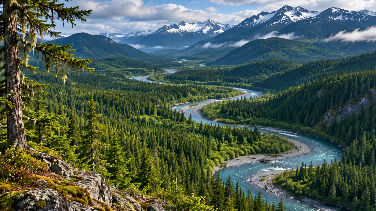
Khutzeymateen, also known as K’tzim-a-deen, protects grizzlies by protecting much of the landscape they use and controlling how visitors enter and watch wildlife. The North Coast sanctuary began as a Class A provincial park established in 1994 specifically for grizzly bears and their habitat. Two adjacent inlet conservancies form part of the larger protected area. BC Parks identifies the Coast Tsimshian First Nations and the Gitsi’is Tribe as collaborative managers. The model joins habitat protection with decisions about access, interpretation and monitoring. For visitors, this means the rules follow the place you are visiting and its conservation purpose, rather than the general expectation that a provincial park is open for ordinary recreation. BC Parks sanctuary overview
Protect the places bears use across the year
The park contains a coastal valley with a large river estuary, wetlands, forest and higher mountain terrain. These are different habitats within the same system. A low wet area may offer early plant growth. A salmon stream can provide food later in the year. Forest and lower slopes can provide cover and places to rest. Protecting the setting around a bear helps preserve these options as its needs change. A boundary drawn only around an easy place for people to see bears would leave much of that ecological work outside the picture.
Research in the Khutzeymateen Valley helps show why that wider view matters. During fieldwork from 1989 through 1991, researchers tracked bears and examined how they used habitats in different seasons. They documented use of valley bottoms and lower slopes, with preferences including forested floodplain areas, wetlands and estuaries. Bedding often occurred on lower side slopes near feeding habitat. These are findings from the study period. They show how a bear can depend on places beyond the open reach that a visitor can see. Khutzeymateen field study
Imagine a bear feeding at a productive part of the estuary. It needs a way to approach, leave and find other resources over time. Cover nearby may allow it to move out of the open. Farther up the valley, it may use a different kind of habitat. In a single visit, a person might see the bear only while it feeds. The other parts of the landscape are still part of how it lives. This is why the model makes sense at watershed scale.
How the park and conservancies work together
The approved management plan covers Khutzeymateen Park, Khutzeymateen Inlet Conservancy and Khutzeymateen Inlet West Conservancy. Together, the protected areas cover the Khutzeymateen River watershed and much of the inlet and surrounding land. BC Parks describes the Inlet Conservancy, established in 2008, as extending protection to key intertidal and foreshore habitat. Looking at the park and conservancies together shows how protection can extend from the head of the valley into the inlet. Protected areas management plan
The terms park and conservancy have different purposes in BC’s protected areas system. On its Khutzeymateen page, BC Parks explains that a conservancy protects biological diversity and natural environments, preserves First Nations’ cultural, ceremonial and social uses, and addresses recreation and compatible use of natural resources. The management plan gives direction for the group of protected areas while identifying where activities and management needs differ. A single name for the destination does not make the rules identical across all of it.
The practical way to read a map of the area is to start with the destination and then look at what the map actually labels. Find the park boundary and the neighbouring conservancies. Notice where they include water and shoreline as well as upland habitat. If you are planning a visit, the map can orient you. Current access details come from BC Parks and the people managing the visit, since a boundary alone does not tell you which activities are allowed at a particular time.
Who helps manage Khutzeymateen
The protected areas lie within Coast Tsimshian traditional territories, with the management plan specifically identifying the Gitsi’is. It describes the importance of the area for continuing social, cultural and economic uses by First Nations. BC Parks says it manages the protected areas collaboratively with Coast Tsimshian First Nations and the Gitsi’is Tribe. The province also describes a commercial bear viewing partnership involving BC Parks, Lax Kw’alaams and permitted guides. These are related parts of how the protected areas are managed and how visitors are hosted.
For a visitor, this matters when asking who sets expectations on the day. The management plan addresses conservation and appropriate use over the long term. The guardian station and permitted guides communicate requirements and help visitors understand their responsibilities at the site. When a host explains what can be shared or where people can go, treat the instruction as part of the visit. The cultural and ecological reasons behind it may be specific to the place.
BC Parks describes contributions from commercial viewing guides supporting shared stewardship initiatives. It lists the visitor centre, interpretation, monitoring and research among the purposes. This is one way an organised visit can be tied to activities that continue after the boat leaves. Monitoring can show how people use the area and provide information managers can use when reviewing access. Interpretation can help visitors understand the habitat and why the conditions exist.
Why viewing access is managed
The sanctuary’s visitor information requires guided tours to use permitted guides, requires visitors to check in at the ranger station on arrival and says unguided public access to the river estuary is prohibited. It describes water-based viewing and prohibits public land access within the park. Check the current BC Parks page and advisories when planning, since permitted operators, seasonal arrangements and access conditions can change. The management plan explains why the rules exist. The current park guidance helps you establish what they mean for your trip.
Disturbance matters because a bear using a productive patch may have fewer options if it repeatedly leaves when people approach. One interaction may be brief. Repeated interruption could reduce the time available to feed, rest or use the area. Site-specific rules give managers ways to limit where and how encounters occur. A person watching from the water can follow guidance even without knowing whether a particular bear would tolerate a closer approach.
Consider the difference between observing a bear that has chosen to remain visible and continuing to look for it after it moves into cover. The first gives you an opportunity to watch under the conditions the guide has established. The second can change where people are relative to the animal and the rest of the habitat. At a managed viewing site, let the guide decide whether the group stays or leaves. The ability to end an observation is part of keeping access compatible with the purpose of the area.
What zoning adds to the protection
The management plan includes a zoning map and a table of activities and facilities. Zoning lets managers consider whether a use fits the purpose of a particular part of the protected area. An inlet can contain busy travel water, sensitive intertidal feeding areas and habitat well away from the routes visitors take. Treating every part identically could overlook those differences. A zone can give managers a way to apply the wider conservation purpose at the scale where a specific use or disturbance occurs.
The plan also includes standards of practice for bear viewing. For a visitor, that means the experience is shaped by more than the permission to enter. The way a group approaches a sighting, where it remains and how it responds when a bear moves can all matter. Those questions apply whether wildlife is easy to see or hidden by the riverbank. A group can follow its guide’s directions without having to judge on its own how a bear would react.
How monitoring can inform later decisions
A long-term plan can identify what managers intend to protect. Monitoring can help them check whether current conditions are consistent with that aim. For example, managers can record visitor use, review recurring concerns and compare those records with information about habitat or bears. The plan includes implementation and review provisions, and the commercial viewing partnership supports monitoring and research. The records used for a decision may take time to collect. A single unusual day at the estuary gives a limited basis for changing access across a season.
It also helps to keep the measures separate. A report of the number of tours describes human use. A record of bears seen by guides can help describe where and when bears were visible, with limits set by observation effort. A habitat survey answers questions about the condition of the watershed. Comparing those sources may reveal a pattern that no single number could explain. The model matters in part because the people responsible for the area have a framework for considering that evidence together.
How to compare a sanctuary visit with other coastal experiences
Khutzeymateen is on BC’s North Coast near Prince Rupert. Eagle Eye Adventures’ grizzly bear expedition from Campbell River visits a different inlet, mainland Toba Inlet, for river viewing with local Klahoose First Nation guides. The Eagle Eye trip uses designated platforms. Khutzeymateen’s park guidance describes water-based viewing. The two settings make a useful comparison if you are trying to understand how hosts organise viewing around different habitats and local arrangements.
Before choosing a trip, check the exact viewing location and how people get there. Ask who manages access, whether viewing happens on land or from the water, and what visitors need to do before arrival. These questions will also help you distinguish a broad regional guide from a listing for an actual departure. The guide to grizzly bear tours in BC offers wider context for that decision. Use current host and park information for requirements that apply to a particular reservation or site. Check whether any restrictions cover the route as well as the viewing location, especially if your plans include time on the water before or after the guided portion.
Questions about the grizzly sanctuary model
Is Khutzeymateen a separate park from K’tzim-a-deen?
BC Parks uses the names together when it describes Khutzeymateen Park and the K’tzim-a-deen Grizzly Bear Sanctuary. The same management plan also covers two adjacent inlet conservancies. If you are looking up access or a map, check whether the information refers to the park alone or to the group of protected areas.
Why do visitors need current access information?
Access depends on the specific protected area, the activity and the arrangements in effect at the time. A map or a historic account of a trip can give context while leaving current instructions unresolved. Use BC Parks’ current visitor information and confirm the arrangements with a permitted guide if you plan to join a tour.
Can I compare the conservation purpose with the chance of seeing a bear?
They answer different questions. The conservation purpose concerns the protection of bears, habitat and cultural values over time. Your chance of a sighting depends on conditions and the behaviour of wild animals during the visit. A guided outing can help you understand what is protected even when the animals remain beyond the view.
Does the sanctuary protect only the estuary?
The estuary is part of a broader coastal watershed. The park and adjacent conservancies encompass forest, wetlands, upland habitat and much of the inlet. Their combined scope helps keep the estuary connected to the other places bears use.